
Bellingcat Challenge: Touching Tarmac
- EJ CR
- Mar 21, 2023
- 2 min read

Updated: Jun 1

Recently I've been testing myself using Bellingcat's OSINT Challenges. In this post I'll walk through how I successfully completed 'Touching Tarmac'.
Touching Tarmac
The challenge is to geolocate this image.

Clearly it is of some sort of airport. The first thing I noticed were the planes. They all have the same livery which suggested to me that this may be a hub or storage facility for a specific airline. Zooming in on the right hand plane gave me this:

Using google to conduct an image search, this livery is quickly identified as belonging to Aero Caribbean.
A quick search suggests that the Aero Caribbean hub is José Martí International Airport in Havana, Cuba.
With an idea of where the image was taken, I needed to verify whether this location was correct.
Verification
The first thing I did was to find the airport of google earth.


Looking at the original image, the position of the planes suggests that they are parked on a round piece of tarmac. On google earth there appears to be one area that immediately looks like a possibility:


Returning to the original image, I was searching for a few specific features to confirm that this is the right location.

There is a large rectangular building at the back of the tarmac section. There appears to be a wall on the left fairly close by and a smaller road that runs from left to right across the round area. In the background there are also two tower like structures.
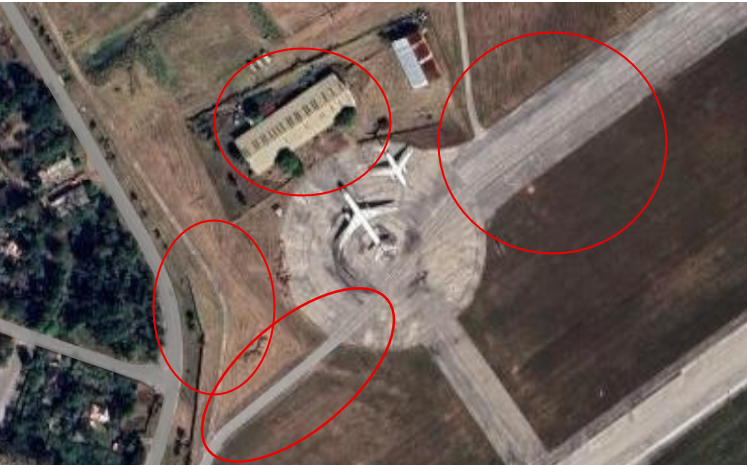
Looking back at google earth, I could see the wall on the left, the road running through, and the rectangular building in the background. This certainly looked like a good candidate. However, to be sure I wanted to see a ground level view to try and spot the tower like structures.
José Martí International Airport is a major airport for Cuba. Like a lot of airports, it is likely to feature on YouTube travel vlogs' B roll. A quick YouTube search gave me a number of videos. Looking through a few, this one caught my eye:
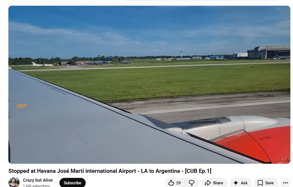
It shows a YouTuber landing in Havana. As you can see, the prominent features all appear in this image:
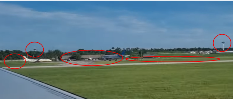
I knew the original image was taken on a taxiway. Given the video shows a landing, I knew that the road in the foreground running paralell to the runway is likely a taxiway. Specifically the one from which the image was taken. Here is a final comparison:

The challenge asked for the ICAO code for this airport. A quick google search revealed this to be MUHA. Challenge complete.

Comments